Quantcast

Castle Rock Ride

Heidi

Der hund ist laut und braun
Aug 22, 2001
10,184
797
Bend, Oregon
About 1:20 drive from Bend is a trail called Castle Rock. Skookum previously proclaimed that this was his favorite trail ride, so I had to give it a go of course. Again, we were in search of something new to ride, again, we weren't disappointed. The book suggested the route as a 14.5 mile loop of 3-5 hours which would put us climbing a gravel road and then singletrack. I pushed for an out and back on the singeltrack and am really happy we did the ride that way. Even though it turned it into about a 12 mile ride, those miles were packed with climbing (2370'), switchback heaven, heavily forested trails, and panorama views. Some of the picture didn't turn out that great because it's so dark back in the forest.


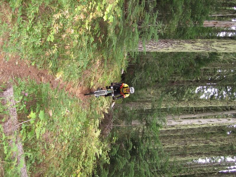
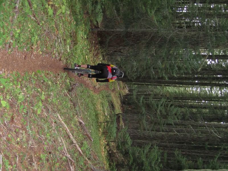
Don't stop for too long or moss will start growing on you!


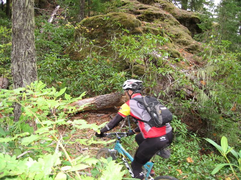
The switchbacks got increasingly steep and difficult, the progression was nice though. It is a total grind upwards towards the end, but of course what I came up, I KNEW I was going to get to ride down.


Those clouds are coming for us!


I did some rock climbing while we were up there. :biggrin:


Heading back down all that trail goodness starts with...A SWITCHBACK!


Upon getting back to our car, we decided to tack on another loop ride in the area. This one was another doozy of a climb (2390') over 6 miles, followed by a 3 mile roaring descent. Rain was threatening for our entire second ride so we kept the pace as high as our legs would allow. The downhill section is a gigantically long straight singletrack that follows the ridge in the forest. It was downright dark in spots! It switchbacked some before popping us back out at the car. Once in the car, it started raining.

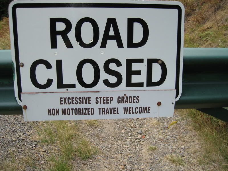
Unfortunately, the sign was not kidding at all. This section was steep and loose and rocky.


More green, more ribbon singetltrack, more HIGH SPEED!


Now that I know where that second trail goes, I'm fairly certain you could better connect the two rides we did...I just need a topo map or to explore.

Tired and happy again.
 

Skookum

bikey's is cool
Jul 26, 2002
10,184
0
in a bear cave
Just thinking about descending King Castle Trail takes me to my happy place.:biggrin: :monkeydance:

But i do want to clarify that i deem a "Trail ride" as a ride being under 20 miles and below 3000'. Just wait til i get home and post my next ride report on the latest "Mountain ride" (20 miler 3 to 5k) i rode last Saturday... Oh man the awesomest viewpoint ever.... Angels Staircase.

Just sitting here thinking about all these awesome trails is frying my brain making me wanna ride.:biggrin:

Heidi is the second trail you rode Castle Rock Trail? King Castle starts near the Belknap Bridge and after crossing a road then takes you to a Y where King Castle ends. The trail from this point is Castle Rock and that's the one that you climbed to the top on. Anyways the bottom of King Castle is an absolute gem, whenever i talk of flow in a trail, that peice defines it. If i knew who the trail builder was i'd do the "i'm not worthy" bow...
There is another trail across the street that looked like alot of climbing for a steep switchback drop off the ridge onto forest road... Not a very inviting trail to me, but a cool name "Frissel".... That's such a cool name for a trail...
Anyways just east is Ollalie trail which appears to be a ridge trail, and has my curiosity piqued for the next time i'm fortunate enough to be in the area. You're a tad closer to the Sisters there too...

i get pretty much all my info from Green Trails maps by the way...

http://www.greentrails.com/

Read the map, ride the trail, pretty simple.

Number 620 is the map concerning this ride area.
 

Heidi

Der hund ist laut und braun
Aug 22, 2001
10,184
797
Bend, Oregon
Skooks, the second ride we did was Ollalie. THe ridge was fun, but didn't have enough character for me. It was THE LONGEST straight ridge singletrack I've ridden I think.
 

Skookum

bikey's is cool
Jul 26, 2002
10,184
0
in a bear cave
Skooks, the second ride we did was Ollalie. THe ridge was fun, but didn't have enough character for me. It was THE LONGEST straight ridge singletrack I've ridden I think.
Good to know thanks. And also good to hear that you and yours were happy riding Castle Rock. i hear alot of people claiming that McKenzie River is overblown as being a great trail so on and so forth. i think it's because it's a "River Trail" ride that has little in the way of gravity or epic view that people may feel jipped from. i think by adding King Castle/Castle Rock to a McKenzie weekend they'll leave feeling satisfied they got the whole spectrum of Backcountry XC riding.

At least i did.:greedy:
 

Skookum

bikey's is cool
Jul 26, 2002
10,184
0
in a bear cave
Do your maps show O'Leary trail in that area?
No not in the ones i own. Which were purchased to own a comprehensive MRT map, which i stitched together since nobody else in our crew had a decent one.

588 Echo Mt
589 Three Fingered Jack
620 McKenzie Bridge
 

Skookum

bikey's is cool
Jul 26, 2002
10,184
0
in a bear cave
I'll keep looking. Check this:

http://outdoorprogram.uoregon.edu/mbrg/

Click on the left for McKenzie Bridge, then go down to O'Leary
Oh my goodness! i slipped and missed spotting the O'Leary trail. Green Trails maps are notorious for having mistakes. i missed looking at it since it's wrote down as not being open to mt. bikes.

Yah wow if that trail is open to bikes then you can use that trail to connect Ollalie and Castle Rock/King Castle into one awesome mountain ride! Starting from King Castle for the loop head up the road to the Ollalie, take the first right on O'Leary on the west side of the mountain. Down the ridge tie into Castle Rock go back up for an easy climb, then tie into King Castle for your final descent. That would be around a 25 miler with around 4700 cumulative vert. Plus you can add an out and back on Ollalie to English Mt. for another 10 miles and a k of vert and the ascent of Castle Rock for 2 more miles and another k making for a possible 37 miler with around 6500' for a super frikkin awesome epic.

Holy crap woman call and find out if O'Leary is open to bikes! Trail 3321....
 

Heidi

Der hund ist laut und braun
Aug 22, 2001
10,184
797
Bend, Oregon
THis is precisely the loop I was thinking about. Hey, it's listed in the guide, so it must be open to bikes!
 

BuddhaRoadkill

I suck at Tool
Feb 15, 2004
988
0
Chintimini Bog


Stellar sleuthing you two. The rains are coming but I'm gonna try and fit this loop in before they do. Looks like next weekend might be better than this one. How is the climbing compared to, say ... Ranger Creek?


Too bad the East Fork Trail [3308] is in wilderness. Could get the best of everything in one ride.
 

Heidi

Der hund ist laut und braun
Aug 22, 2001
10,184
797
Bend, Oregon
I've never ridden Ranger Creek. I can tell you the climb up King Castle and Castle Rock wasn't bad at all with the exception of a few really tight switchbacks, but the gravel and paved road we road to the top of Ollalie Trail seemed long. I'm really interested to see what the O'Leary Trail is like. Let me know if you do this.
 

Borneo

Turbo Monkey
Mar 22, 2004
1,010
0
Duvall
Hey! I've ridden Ranger Creek! We all know how much Heidi and Derek want to come up and do a long 410/Greenwater weekend with us.
They'd kill the Cascade Triple Crown.:bonk: :happydance:

I see this as all just more dirty brown ribbons of joy I need to roll over before I die....

Muchos gracias, as always.... :)