Next time you're in the area of Bellingham, Washington, stay and ride for a while. This photo article covers just a small amount of all the riding to be had here.
---
Words by David Waugh
Photos by David Waugh & Patrick Branch
Bellingham, Washington is a city of about 75,000 people located between the foothills of the Cascade Mountains and Bellingham Bay. Seattle is an hour and a half to the south, Vancouver, B.C. is less than an hour and a half north if the border has no wait time, and Mt. Baker is an hour and a half to the east. Bellingham is a central location for many things, and there is more biking to be had here than some people realize; there is something for everyone. The main and most well known riding area is Galbraith, also known as South Lookout Mountain on the east edge of town.
Galbraith has been the premier riding destination of Bellingham for many years, since the sport was young. The organization in charge of trail work on the mountain, the WHIMPs (Whatcom Independent Mountain Pedalers), or more recently called the WMBC (WHIMPs Mountain Bike Coalition), formed in 1986 and has been a strong force ever since. Much of the trail on Galbraith has been built to IMBA standards on private land owned by Trillium Corporation, over 3,600 acres. The current (yet ever-expanding) trail system includes over 40 miles of trail of all kinds, including cross-country, all-mountain, and freeride. Galbraiths summit is over 1700 feet and the trails cover 1,500 feet of elevation; while not the tallest hill around, the elevation is well used. Views from the top include much of the surrounding area, namely Mt. Baker and the Twin Sisters, Lake Whatcom, the Canadian Coastal Range mountains, Bellingham Bay and the San Juan Islands, Chuckanut Mt., and Lake Padden; from other areas yet more can be seen including Lake Samish and even Mt. Rainier on clear days. One of the key aspects of Galbraith is the multiple routes to be had. A ride can be nearly any length of time; a quick short ride could be thirty minutes, an average all-mountain ride could be two or three hours, or a long ride could be four, five, or even six hours. Many trails on the mountain are short at less than a mile long, but much of that is due to trails gaining a new name after crossing roads.
Describing Galbraith as a whole is not entirely easy, as there is much variation. Following is a selection of photos from different trails on the mountain accompanied with a description of the trail. This is only a small snapshot of all that the mountain contains:
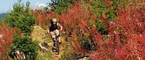
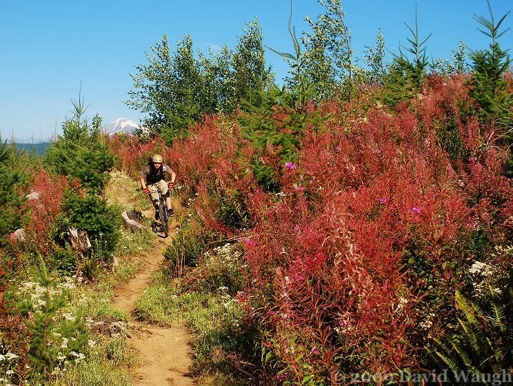
Wonderland: Starting at the top of the mountain, Wonderland is the beginning of the longest cross-country route down the mountain, heading north. Except for the very beginning of the trail, the entire trail is in clearcut, although the new trees are growing fast. For a few more years at the most until the young trees grow too tall, Wonderland is the best place for getting a view of the surrounding area.
Pat riding Wonderland with Mt. Baker in the background
Self portrait on Wonderland in spring with Bellingham Bay and the San Juan Islands in view
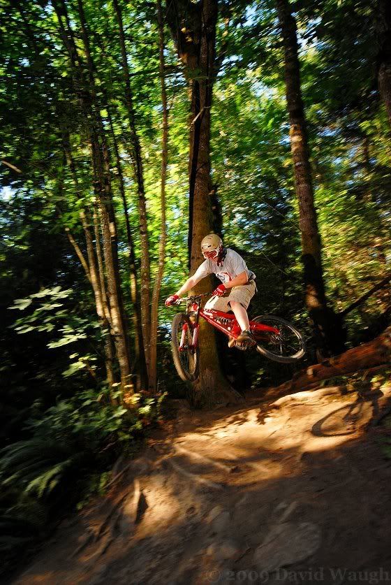
Evolution: Though not the first freeride trail on Galbraith, Evolution was one of the first projects of the WMBCs freeride trail crew a few years ago. The trail starts from the top of the mountain and heads south (where most of the freeride trails on the mountain are). It is high speed in most areas and features multiple jumps, drops, ladders, and a long log ride skinny at the top. Currently the trail is becoming aged and in response, work is likely to happen this season to freshen the trail up once again.
Pat on the entrance jump to Evolution (note his chain falling off in mid-air)
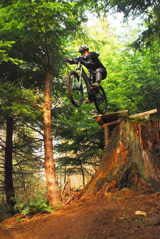
A rider hitting the second stump drop on Evolution
Mullet: Mullet is a relatively new trail of a few years old and has spent all of its life evolving thus far. When first built by the freeride crew, it didnt look much like a freeride trail, and in fact many cross-country riders enjoyed it as an up. Over time, however, the trail was buffed out and more features were added; downhill speed in many sections has increased noticeably. Near the bottom the trail crosses Kaiser (the next trail described). Up until two years ago the trail used a few hundred feet of Kaiser before splitting off again for the exit. This resulted in increased erosion and damages on Kaiser, and resulted in the trail being rerouted along the path of an old trail that at the bottom used to cross a large swamp on a deteriorating ladder and log bridge. Trillium, which has a good relationship with the WMBC, took up the task of building a new bridge over the swamp. In a day and a half, the Trillium crew built a 360 foot long boardwalk bridge over the swamp.
Pat manualing a fast section of Mullet
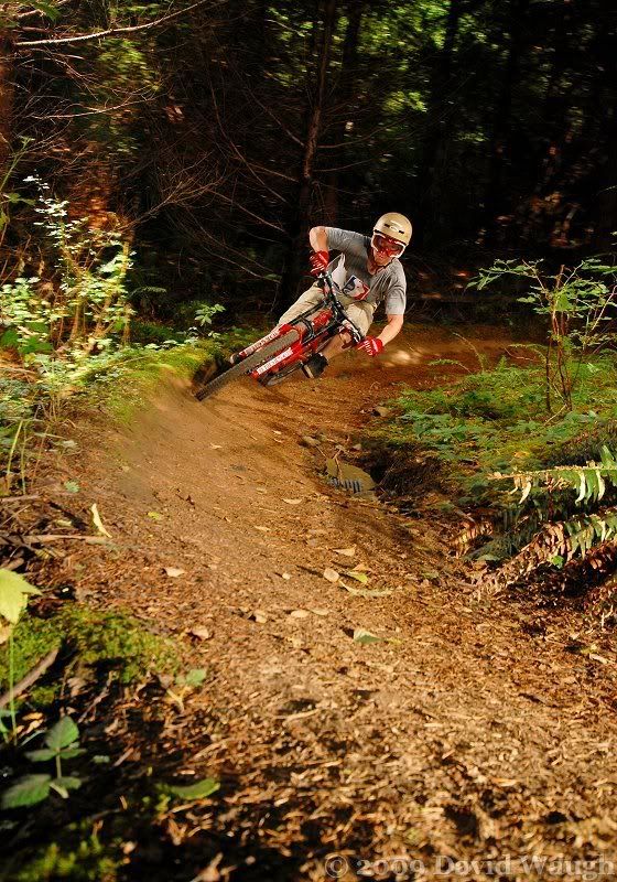
Kaiser: The location of Kaiser has historically made it a muddy trail in the wet season, but recent drainage work has done much to help it out. Built centrally on the mountain, Kaiser was one of the early trails and has gone through changes over time, but still remains a favorite to many. The diverse forest the trail runs through makes it particularly scenic. Although overall a relatively easy trail, a few rooty sections make for some more technical riding.
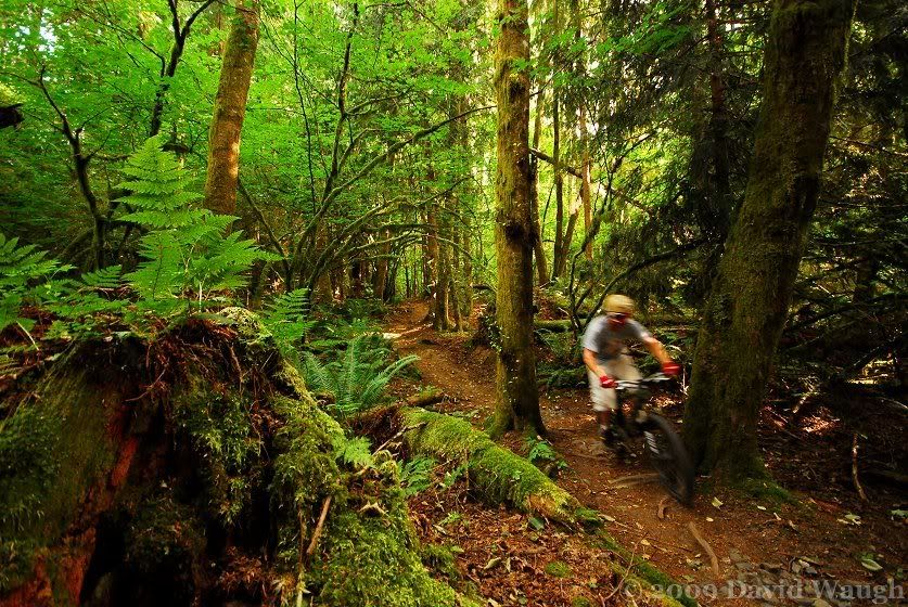
Pat on the last downhill of Kaiser heading north
Esophagus: Esophagus is a short and fast trail. It follows the path of what appears to be an old road before splitting off into the woods on a recent reroute (lengthening the trail and bypassing an eroding drainage chute that used to be the trail). The top of the trail features rock coming out of the ground which can be used as a jump, and also doubles as the exit for Lower Arsenio, the trail that links into Esophagus.
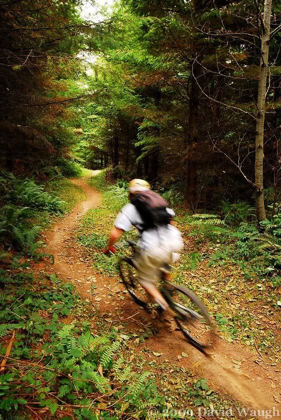
Pat riding Esophagus with speed

Me jumping the rock on Esophagus
El Pollo Elastico: The Rubber Chicken is a segment of a longer trail line: Pick up Sticks and Fire Ring come before it, and Mas Pollo (a.k.a. Ewok Village) finishes it off. The trail is one of a series of trails built by Bob, whose namesake trail is described later. His trails make up some of the best all-mountain riding in the Bellingham area. El Pollo is a fast trail and contains enough technical features that one must remain focused. The top starts out with a small rock jump/drop/roll into a series of tight switchbacking berms. It then opens up into a straight downhill with two small high-speed jumps that also double as water bars; riders must check their speed as the trail then turns right onto a short split-log bridge over a drainage. The trail continues on with short flat segments split up with downhill.

Me riding a corner on El Pollo
Pat railing a berm on El Pollo
Papa Bear: The Three Bears and Goldilocks were added to the mountain in 2007 to create a great all-mountain cross-country loop. In fact, Goldilocks is the only trail that is truly new; The Bears existed before in a different state. They had been old motorcycle trails and had been largely untouched by mountain bikers since they were not well connected to the rest of the mountain. The trail now known as Papa Bear used to be known as Chainsaw Massacre, a name that fit the trail well. It cut straight up and down the hill, with little in between; sometimes the trail was only 20 feet away from itself. This was quite easy to fix. The tops of the worst hills were simply connected and the old trail covered up. Papa Bear still consists of many downs and ups, but they are mellower. Being one of the longer trails on the mountain, Papa Bear can be a real workout for unprepared riders.

Me coming to the bottom of a hill on Papa Bear
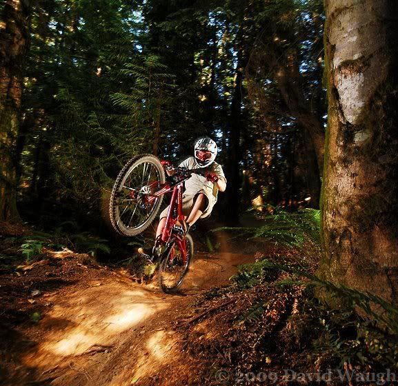
Bobs: Bobs is a classic Galbraith trail and one that can be enjoyed by the widest range of riding styles. For advanced riders Bobs is a mildly technical trail at an average riding speed, but like any trail, the faster a rider takes the trail, the more technical it gets. Roots and rocks, flat corners at the bottom of some downhills, a few drops and jumps, some log rides and a skinny over a swamp make for a varied ride. Located near the bottom of the hill on the north side, Bobs is a favored choice by many as the final downhill trail of a ride.

Brad managing to throw a tabletop off something that most riders wouldn't even consider a jump on Lower Bob's
Pat dropping out of the end of Bob's
Ridge: The Ridge Trail is likely the most heavily used trail on the mountain. It is the only main climbing route from the north side and due to its views of Bellingham and easy access from nearby neighborhoods, also sees some of the heaviest foot traffic on the mountain. It is also a popular downhill, the only alternative to Bobs, leaving from the same junction. Ridge is one of the longest trails on the mountain at about a mile and a quarter long.
Pat riding the cliffside line on Ridge

A random rider coming up the Ridge with part of town visible in the background
For more information on Galbraith and the WMBC, visit the website at http://www.whimpsmtb.com/