While I was at a research conference in Maine this past week I was able to sneak away for an afternoon for a ride. Rockland, a local Maine monkey was to act as my guide for the ride and was even gracious enough to provide a bike for me. Thanks Rockland!
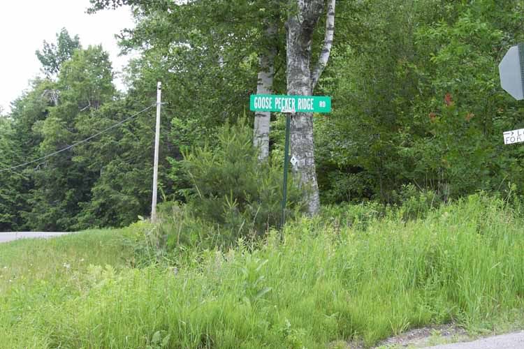
We had arranged to meet at some trails around halfway between my conference location and the town where Rockland lives to ride. I was suffering from a massive hangover from beer-pong until 4am at the conference the night before. I was feeling pretty rough around the edges, however I knew it was going to be a good time when the Mapquest driving directions included at turn on to "Goose Pecker Ridge Road". I'm not sure what a pecker ridge is or even why a goose should have one but sure enough there it was:
Turns out that Rockland had scouted the trails that we had originally planned to ride earlier in the week. Apparently they had suffered through the recent rains and storms NE has been having. He decided that we should head over to the Camden Snow Bowl, a NORBA xc race course. After a minute or two of adjusting the bike to fit me, we took off.
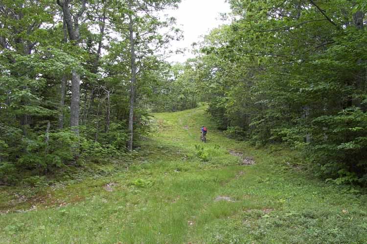
The first part of the ride involved some serious climbing up some rooty, rocky, off-camber switch backs. I'm pretty sure I walked more than I rode up this section. The single track zig-zagged back and forth up and across the ski slopes of the "snow bowl". Generally as the single-track crossed over a ski trail you had a nice break before the next set of steep switch backs started.
Since the climbing was tough, there were plenty of opportunities to stop for a break to snap pictures.
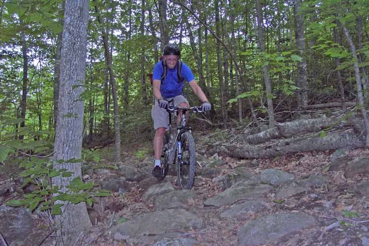
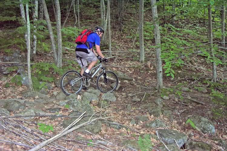
Jdschall negotiating a rock garden on the climb up (notice it looks like I am trying not to heave up last night's beer):
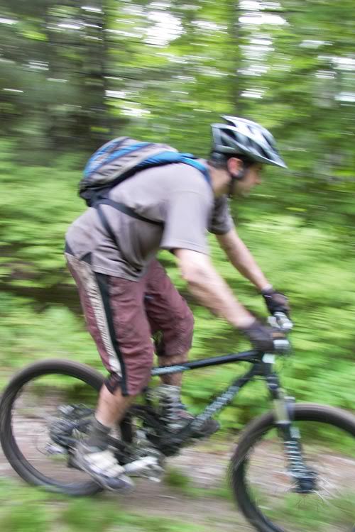
Rockland on the same section:
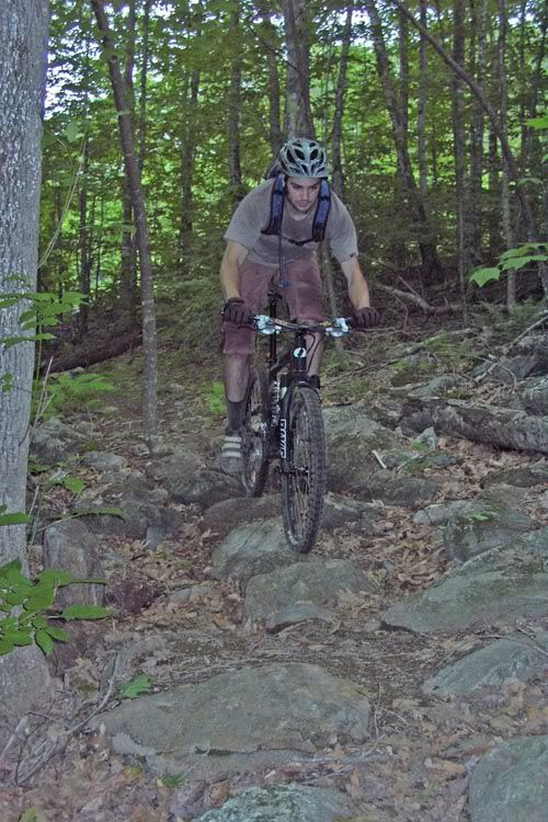
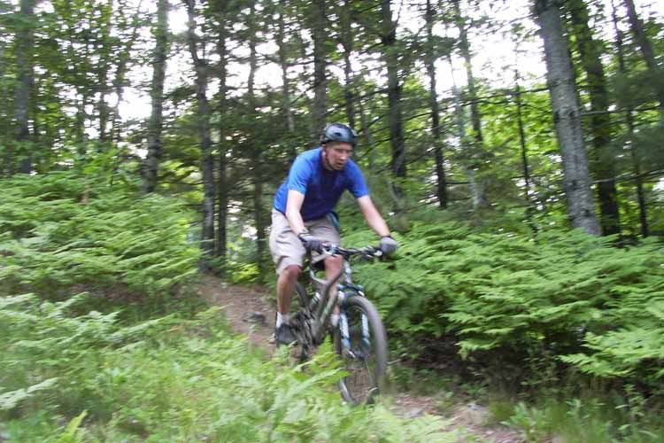
Jdschall climbing up slope:
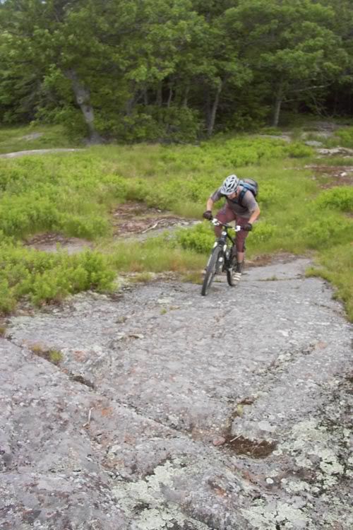
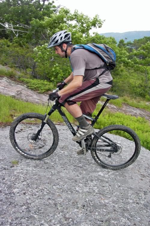
At some point we left the NORBA course and headed straight for the top of the mountain. The trail turned from single track to a series of exposed granite slabs with super tacky traction. I was able to cruise up a few of them, but certainly not all. Rockland seemed to have no troubles what so ever.
Rockland living up to his name:
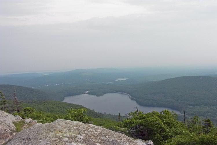
The trail continued like this for awhile until we got near the top of the ski lifts. Around this point we ditched the bikes and continued on up by foot. From the top you could see forever, the ocean and a few little towns to the east and lots of little lakes to the west.
Looking South East towards Camden and the town of Rockland:
We took a quick descent back down the ski slopes. No pictures here, just riding. I'll summarize in words: fast, more exposed granite, tire-sucking mud hidden under waist high ferns, fun.
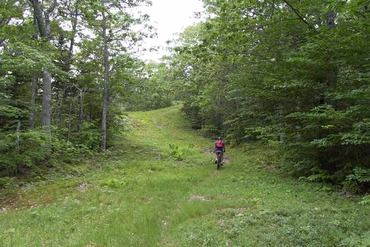
About halfway down the mountain we hooked back up with the xc trail. I have to say this was one of the toughest xc trails I have ever ridden. There is no way I could imagine pounding out 4 laps on this thing. The trail can be summarized in 3 words, rocks, roots, mud, each pretty much everywhere at the same time in the same place. A few miles and a few small climbs later we were headed back towards the trail head. The last few sections were mostly steep, fast and twisty. We got a few more pictures in this area:
Jdschall rockgarden:
Rockland cruising down the t-bar line:
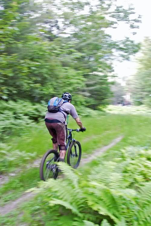
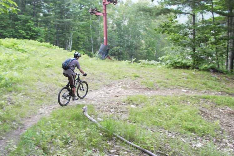
Jdschall exiting the woods:
Rockland still cruising:
Rockland in a sweeping turn that was actually a hell of a lot steeper and more fun than this picture suggests:
That's all the good pictures I have. Total mileage was only around 6. The trail head to summit elevation gain was right at 1000' feet. I think that the ride took us around 2 hours. No mechanicals, no major falls, and most importantly I kept contents of my stomach in place.
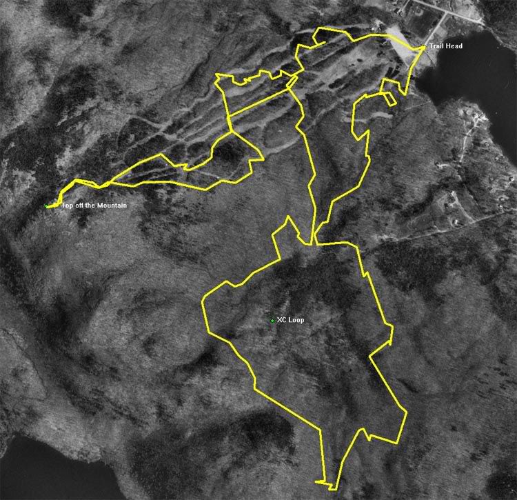
Here's the GPS Track:
After the ride, Rockland took me back to his place for a chicken dinner which his girlfriend was kind enough to prepare for us. It was an outstanding end to an outstanding ride.
After I got back I checked out the trail description on MTBR. They rate it at 4.83 chilis out of 5 and "This is a NORBA trail and considered one of the toughest." I haven't ridden any other NORBA xc trails, so I have nothing to compare to really, but I would at least agree it was tough!
Thanks again Rockland for the guidance, the bike, and dinner!
We had arranged to meet at some trails around halfway between my conference location and the town where Rockland lives to ride. I was suffering from a massive hangover from beer-pong until 4am at the conference the night before. I was feeling pretty rough around the edges, however I knew it was going to be a good time when the Mapquest driving directions included at turn on to "Goose Pecker Ridge Road". I'm not sure what a pecker ridge is or even why a goose should have one but sure enough there it was:
Turns out that Rockland had scouted the trails that we had originally planned to ride earlier in the week. Apparently they had suffered through the recent rains and storms NE has been having. He decided that we should head over to the Camden Snow Bowl, a NORBA xc race course. After a minute or two of adjusting the bike to fit me, we took off.
The first part of the ride involved some serious climbing up some rooty, rocky, off-camber switch backs. I'm pretty sure I walked more than I rode up this section. The single track zig-zagged back and forth up and across the ski slopes of the "snow bowl". Generally as the single-track crossed over a ski trail you had a nice break before the next set of steep switch backs started.
Since the climbing was tough, there were plenty of opportunities to stop for a break to snap pictures.
Jdschall negotiating a rock garden on the climb up (notice it looks like I am trying not to heave up last night's beer):
Rockland on the same section:
Jdschall climbing up slope:
At some point we left the NORBA course and headed straight for the top of the mountain. The trail turned from single track to a series of exposed granite slabs with super tacky traction. I was able to cruise up a few of them, but certainly not all. Rockland seemed to have no troubles what so ever.
Rockland living up to his name:
The trail continued like this for awhile until we got near the top of the ski lifts. Around this point we ditched the bikes and continued on up by foot. From the top you could see forever, the ocean and a few little towns to the east and lots of little lakes to the west.
Looking South East towards Camden and the town of Rockland:
We took a quick descent back down the ski slopes. No pictures here, just riding. I'll summarize in words: fast, more exposed granite, tire-sucking mud hidden under waist high ferns, fun.
About halfway down the mountain we hooked back up with the xc trail. I have to say this was one of the toughest xc trails I have ever ridden. There is no way I could imagine pounding out 4 laps on this thing. The trail can be summarized in 3 words, rocks, roots, mud, each pretty much everywhere at the same time in the same place. A few miles and a few small climbs later we were headed back towards the trail head. The last few sections were mostly steep, fast and twisty. We got a few more pictures in this area:
Jdschall rockgarden:
Rockland cruising down the t-bar line:
Jdschall exiting the woods:
Rockland still cruising:
Rockland in a sweeping turn that was actually a hell of a lot steeper and more fun than this picture suggests:
That's all the good pictures I have. Total mileage was only around 6. The trail head to summit elevation gain was right at 1000' feet. I think that the ride took us around 2 hours. No mechanicals, no major falls, and most importantly I kept contents of my stomach in place.
Here's the GPS Track:
After the ride, Rockland took me back to his place for a chicken dinner which his girlfriend was kind enough to prepare for us. It was an outstanding end to an outstanding ride.
After I got back I checked out the trail description on MTBR. They rate it at 4.83 chilis out of 5 and "This is a NORBA trail and considered one of the toughest." I haven't ridden any other NORBA xc trails, so I have nothing to compare to really, but I would at least agree it was tough!
Thanks again Rockland for the guidance, the bike, and dinner!

") Dave it was great meeting you! It was a fun ride. I just learned that the trail guru has been working on the continuation of the switchback climb. He must have hidden the turn, and we rode right by it. Hope the rest of your trip went well.
Dave it was great meeting you! It was a fun ride. I just learned that the trail guru has been working on the continuation of the switchback climb. He must have hidden the turn, and we rode right by it. Hope the rest of your trip went well. 