Okay, I know who is going to Snowshoe - most everybody. Is anybody going to be at Wintergreen? I'll probably ride DH on Saturday and XC (or hike) on Sunday.
Okay, I know who is going to Snowshoe - most everybody. Is anybody going to be at Wintergreen? I'll probably ride DH on Saturday and XC (or hike) on Sunday.
Where will you be riding XC at? I live about 15 minutes from Wintergreen but I have never ridden there. Do they have XC trails? I was thinking it was just shuttle stuff. Are you planning on riding there or someplace close like Whetstone or Sherando? I have family coming in for the weekend, but I may be able to sneak out early on Sunday.
Where will you be riding XC at? I live about 15 minutes from Wintergreen but I have never ridden there. Do they have XC trails? I was thinking it was just shuttle stuff. Are you planning on riding there or someplace close like Whetstone or Sherando? I have family coming in for the weekend, but I may be able to sneak out early on Sunday.
I'm not sure. I have maps of GWNF for that area. My wife and I might just try to find something that looks mellow. Any ideas? Either that or go for a hike, Crabtree falls or something like that. She's 5 months pregnant so we have to take it kind of easy.
I have heard that Wintergreen does have xc trails.
Well, mellow is not a typical description for the area when it comes to XC trails. Most mellow I can think of would be Walnut Creek (30 minute drive) or the North River Gorge trail in Stokesville (45 minute drive)
We might have to hit the North River Gorge trail. We can just jump over to I-81 from Wintergreen and head north. We did the North River trail from the top and some other Reddish stuff last spring but that was pre-prego.
How is Big Levels if you start from the parkway? From the topo it looks pretty flat on top.
Birdman, If you come over to dh look for a guy with a black Soul Cycles hardtail and probably a bright orange jersey. I'll be riding Saturday.
We might have to hit the North River Gorge trail. We can just jump over to I-81 from Wintergreen and head north. We did the North River trail from the top and some other Reddish stuff last spring but that was pre-prego.
Well, the only semi "flat" area is the fire road at the top from Bald Mountain. There are some ridge lines like Torrey and Kennedy, but they are very technical with a ton of rock gardens. In fact, Kennedy is almost one solid rock garden and Torrey ridge isn't too far behind.
You could always shuttle Mill Creek trail or Slacks>White Rock. Really awesome descents.
Well I rode my freaking ass off at Wintergreen Saturday. I was absolutely the only rider there. I had the whole mountain to myself and there was zero wait for the lifts. Figuring $35 for the lift ticket, I was way under a dollar per run. I started out on some of the beginner / intermediate runs. By the end of the day I was hitting the some of the advance trails, mostly Blanche's and the Ewok trails, over and over. I highly recommend it to beginner and intermediate DH / free riders. More experienced riders might find the runs to be a little short. I was doing runs in the 3-4 minute range, and I think I'm pretty slow. A fast rider might get down the hill in 2 minutes. It was very 'hardtail-ible' although I didn't hit many of the drops.
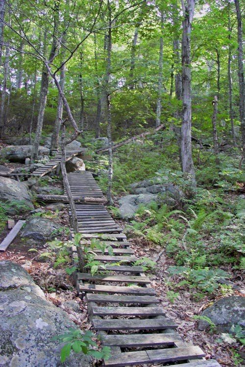
The only picture of the day:
As for XC at wintergreen, there was none on-site. False advertising on their part. My wife was a little disappointed not to get to ride but there were plenty of hiking trails so she and the dog wandered around in the woods all day.
Sunday we ended up hiking on the AT off the parkway. We did a short out and back up Humpback Mountain which had great views of the ski slopes at wintergreen. The weather all weekend was great. Cool and slightly overcast. I can't wait to go back.
I'm glad to hear that there are some hiking trails for my folks to occupy themselves on while I get lost. Any tips for navigating the mountain before we pick a weekend to go up ?
I'm glad to hear that there are some hiking trails for my folks to occupy themselves on while I get lost. Any tips for navigating the mountain before we pick a weekend to go up ?
Tip number 1. Get a good tracking dog. May I suggest a lab / hound mix? Nobody at Wintergreen knows where the hiking trails are. You can buy a map at the visitors center but it is terrible. Obvious landmarks such as buildings / ski lifts / slopes didn't even register on the map. WTF? Your family will be on their own finding them. If they do manage to find them, my wife said that they were largely overgrown and weren't well blazed at that. She said at one point she was completely lost and that she just let the dog find the trail. Apparently it worked. For some reason our dog always knows where to go.
Tip 2. Just point you front wheel downhill and let go of the brakes and you'll end up at the lift at the bottom. You can buy your lift ticket at the Out-of-bounds center in the round tent. The DH trails are well marked (unlike the hiking trails) and you shouldn't get lost. Each trail is numbered and uses green, blue, red, and red + arrows rating system. Green = easy, blue = intermediate, red + 3 down arrows = better look first.
Well my golden retriever tends to just head for large bodies of water so I don't think he'll help much. Anyother things for my parents to do while I'm up there ?
Well my golden retriever tends to just head for large bodies of water so I don't think he'll help much. Anyother things for my parents to do while I'm up there ?
This site uses cookies to help personalise content, tailor your experience and to keep you logged in if you register.
By continuing to use this site, you are consenting to our use of cookies.